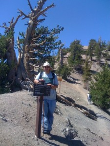
Just before the peak there is a trail switch to the Pacific Crest Trail that takes you to Mt. Burnham.
When I was 12 yrs. old I was a member of Troop 894 out of Chula Vista, California. We were a part of the San Diego Scout Council. My scoutmaster at the time was a retired marine and he really liked to hike. The last time I climbed Mt. Baden Powell I was 12 yrs. old. It was my first official hike with the troop. About a month previous to the hike I did a training hike up Stonewall Peak to prove to the troop that I was worthy of Mt. Baden Powell. At that time we came up the Mine Gulch trail. I don’t remember much, but I did remember the mine at the beginning of the trail, the monument at the top, and my first experience with a trail register.
It was with these memories that I made my second trip up Mt. Baden Powell. Whereas before my troop went up the more remote Mine Gulch Trail route, this time I went up the more popular Vincent Gap trail. Normally I like to get out on the trail as early as possible, but due to logistics I didn’t get on the trail until 8am (7/14/12). By that time the sun wasn’t too bad, but later coming down I would pay for being late on the trail by hiking in the heat.

The last .3 miles of the Baden Powell Trail is very impressive as you walk across the spine of the mountain.
The trail itself is well maintained. There are vault toilets at the trail head, but they are not well maintained and don’t even lock. The beginning of the trail has a lot of switch backs, but there are plenty of good resting places along the way and signs marking 2 and 3 miles. About .3 miles from the top you turn a sharp corner and start walking along the spine of the mountain. With 100 ft. drop offs on both sides of the trail there is no temptation to deviate from the pass. Walking along the spine you wonder how anything could grow up there, but almost in defiance of that thought you are confronted with some really old knotty pine trees growing right into rock basin. At the end of the spine there is a cutoff for the PCT (Pacific Crest Trail).

My thought upon seeing the Baden Powell monument was "Who in the heck would lug all that concrete up here?!"
My goal for this hike was Mt. Baden Powell. On my little guide map, it listed the 4 mile hike as a hard hike. With Mt. San Jacinto in my mind I told Denise to come back for me around 2pm. I ended up reaching the summit at 9:30 am. I got out my cellphone when I reached the top, but like most remote areas I had no reception. I did try to send out a text message from the the top, but it didn’t actually get to Denise until 7pm. Knowing there was no car in site for several hours and having a fair amount of energy in me I descended back to the PCT and decided to see how far I could get.
How far I could get was about a mile and a half down the trail to the Peak of Mt. Burnham.
In case your wondering who Burnham was he too was scout. Major Frederick Russell Burnham, was a explorer and scout who was known to advance scouting in two continents (which two I don’t know because I failed to read the rest of the wikipedia article). The top of Mt. Burnham was about as obscure as his fame. If it wasn’t for the help of some Sierra Club members I would have easily mistook the time spur trail as a deer trail and not have gone up the slope. There was not much at the top, I looked for a marker to confirm where I was but only found a bunch of brush. Luckily I had my GPS watch on me so when I got back I was able to confirm that I was indeed on top of Mt. Burnham.
Going back down the trail was interesting. At first it was hard because in order to get to Mr. Burnham I had to descent down the PCT, so to get back to the spine I had to ascend again. Coming down the switch backs was easy I had a really good pace. I passed a lot of hikers still climbing the trail. I don’t know what time they started but I wouldn’t want to be hiking up any mountain trail at 12pm. When I was about .3 miles from the trailhead I encountered a brown labrador coming up the mountain. Trying to be courteous to any uphill climber I moved off the trail to let the dog pass. I am not sure what was up with the dog but it didn’t like me and started to bark at me. At that point I got back on the trail (didn’t want to fall off a switchback) and raised the pointed end of hiking stick at the dog. The owner at this point was coming around the bend and said “what are you doing?!” My reply was “please control your dog!”, my thought was “if you can’t follow the rules and keep your dog on a leash, you have no recourse if I end up hurting your dog.” Don’t get me wrong I like animals. I don’t want to hurt any animal, including a dog, but when you’ve just hike for 10 miles the last thing you want to encounter is a barking dog off it’s leash. I would also like to say that along the way I saw 4 other dogs on the trail and they were all on leashes and they were all very polite (if you want funny, just wait until you see a boxer with a backpack on).
Other than the minor dog incident, the trail was pretty easy. I wouldn’t call it a beginner hike, but it wasn’t something one would have to train too hard for. I saw all sorts of people hiking the trail. I saw kids as young as 6 and met a guy who told me he was in his 70’s. What I didn’t see were people carrying a lot of water, which made me worry a bit for them. I carried 2.5 liters of water, which is a bit overkill (but I like to be prepared), but I saw a lot of people with nothing more than a 500 ml bottle which I thought was too little. Then again what do I know, I didn’t hear of any major mountain rescues that day so it couldn’t have been too bad. I got back to the trail head at 12:35 pm. Luckily I had a book in my daypack and there was a bench at the trail head. Denise never got my text messages but she was there at 2 pm to pick me up.
Keeping up with my marathon training I got these stats from my GPS watch:


Fun hike. You were going up at a pretty good pace! We took 2 hours, but we took a lot of pictures, especially at the ancient pine tree just before the spine.